
 Art by CONTRA
How We Got Here
October 11, 2026 · by George Kramer
As many of you may know, I am something of a historian and believe, firmly, that when it comes to the life of a community things don’t just happen but are the culmination of a long series of events, some planned, some accidental or even tragic. Over the next few weeks it is my hope to put my thinking about how Ashland got to where it is today on paper, taking the long view, both the good and the bad. I will post these in all the typical social media locations and hope that they are 1) interesting, 2) informative, and 3) provide you with some context for our discussions about the city’s future.
Part 1 La Grande
I am reminded of an interview question from some years ago. It was an OPB radio show, broadcast live from a coffee shop that no longer exists on 4th Street, held to commemorate the anniversary (the 75th?) of the Oregon Shakespeare Festival. I was asked, as a “historian,” what I thought Ashland would be like had Angus Bowmer not looked at the ruins of the Chautauqua dome and thought to put on a Shakespeare play there. Without a lot of thought, I answered “La Grande,” which almost immediately got me into all sorts of trouble with the Ashland Chamber of Commerce and others (not to mention friends in La Grande) who were indignant that I would compare our wonderful, vibrant, community, to a place in Eastern Oregon many can’t locate without a map.
“We have our lovely valley and scenery.” La Grande is located in a beautiful valley too.
“We are on a major highway.” La Grande is located on I-84.
“We have the university.” La Grande is the home of Eastern Oregon University, which literally has an architectural duplicate of SOU’s Churchill Hall.
La Grande has other neat amenities, from lovely parks and the rest. Granted it doesn’t have our economy or tourism draw but had Angus taken a job at Eastern Oregon College, maybe it would.
The next segment will cover changes to Ashland after World War Two. Contents
Part 2 After World War Two

Like most of Oregon, Ashland changed significantly during and after World War Two. During the war people came to Oregon, to work at Camp White or other government installations, and after the war many soldiers and workers returned and stayed. The Federal GI Home Loan program and the nation’s strong economy led to huge increases in construction and Oregon’s timber industry took off. In 1948 Ashland boasted more than a dozen lumber mills, which provided decent paying jobs for workers, jobs that allowed folks to raise a family and buy a home. Ashland’s population grew, to 7500, up from 4700 in 1940.
Other changes occurred too. The rerouting of US 99 through downtown, creating North Main Street as a straight(er) shot from Helman Street to Oak, eliminated the tortuous little bend around the Plaza. In 1956, the state completed the “couplet,” creating what we know as Lithia Way, an entirely new road between East Main, by the fire station, that bypassed downtown before reconnecting at Helman. Times were good, jobs were plentiful, and Ashland High graduates could start or join a family-owned business, get a job in a local mill, or relocate and pursue their dreams. Southern Oregon College, under Elmo Stevenson, grew too, bringing new students and professionals into the valley. The small, seasonal Oregon Shakespeare Festival hired William Patton as its first full-time general manager in 1953, and in 1959 completed the Elizabethan Theatre, expanding its offerings and bringing (more) tourists, art, and culture to Ashland.
But there were warning signs on the horizon. Planning for the interstate, an entirely new road alignment that would bypass the city entirely, was underway, and passenger rail travel to Ashland, once a mainstay in the city’s success, declined after the war before ending entirely in 1955. Rail freight was being supplanted by trucks, reducing jobs and leaving the housing around the depot at the foot of 4th Street empty and run down. Success in the growing timber industry required capital, often beyond the capacity of smaller firms. Ashland’s location at the end of the valley, surrounded by mountains, worked against it, as bigger and better financed operations developed in Medford and White City. By 1964 most of the small family-owned mills had closed, taking those good-paying jobs with them.
In 1964, Elmer “Mike” Biegel, the city’s administrator for over 30 years (some people say that Pioneer Mike, on the Plaza, was named after him), retired. New people, with new ideas, were moving here, some drawn by the expansion of the college, others by the growing tourism industry or what we today would call the “quality of life.” Biegel’s successor at city hall, Robert Ayre, “brought Ashland into the 20th century” with new organizational changes to city government. A cadre of long-time department heads, like Al Alsing at public works and Chet Corry at the parks department, were on hand to help oversee the transition. Perhaps most importantly, for our purposes, City Administrator Ayre initiated the formation of what became “The Committee of Fifty,” a group that represented most of the organizations and interests in Ashland, to identify and prioritize Ashland’s future.
Over the next few years the committee brought in consultants and experts, who connected with the public, held meetings, and worked to craft a shared vision for Ashland’s future. This led to improved zoning, the (re)construction of a water treatment plant, improved sewer and storm drains, a new fire station, more parks, the ski resort and a better and bigger hospital. The Bellview area, previously an independent, unincorporated, community was annexed, expanding the city limits, and the Quiet Village neighborhood (and with it Helman Elementary) was developed. With support and encouragement from the Committee of Fifty, a comprehensive downtown plan was developed for Ashland, focused on tourism. It was adopted in March 1967, as a blueprint for the future. In 1969 the Federal government provided funding to redesign the Plaza and provided money for what would become the Bowmer Theatre, giving OSFA two stages and extending their season from the Spring thru the Summer and into the Fall, for economic development. Because it couldn’t directly receive federal funding, OSFA gave all its property to the city, who then leased it back to the festival.
Ashland’s leaders contemplated razing much of the Railroad District, which was zoned for high-density residential, and replacing the decaying old housing with multi-family housing. We needed the housing. In 1960, Ashland’s population had grown to 9100. By 1970, the year the Bowmer Theatre opened, it would grow to 12,300. Continued growth was projected to quadruple the city’s footprint, with a potential population of as much as 70,000. That population would require expanding the city boundaries to the ranch land across the freeway to the north, and as far west as Valley View, at the new freeway on-ramp.
Next, the state steps in. Contents
Part 3 The State Steps In
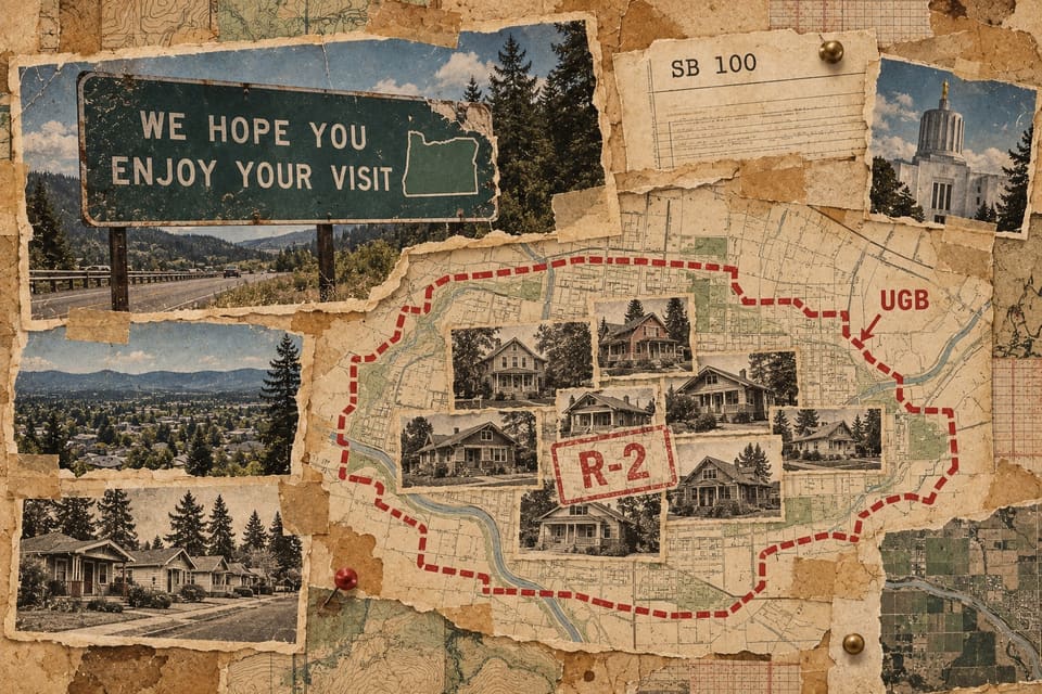
Just as Ashland grew after WWII, so too did Oregon, which doubled in population between 1940 and 1970. This prompted Governor Tom McCall, an iconic old-style “leave me alone” Oregon Republican, to say, in effect, “Visit Oregon, but for goodness sake don’t move here!” The “Welcome” signs at Oregon’s borders during this era famously, if rather pointedly, proclaimed “We Hope You Enjoy Your Visit.”
McCall was not the only leader concerned about the impacts of growth on Oregon’s quality of life. In 1969 the state legislature passed SB 10, an effort to preserve farm and resource land from urban encroachment. It obligated Oregon cities and counties to develop comprehensive planning to manage growth. Supporters of SB 10, most notably Sen. Hector McPherson, Jr., a dairy farmer from Benton County, weren’t done. In 1973 the state passed SB 100, the Land Conservation and Development Act. SB 100, the first law of its kind in the nation (and still one of the only examples of statewide land-use planning) created the Land Conservation and Development Commission, a state entity that required cities to establish a plan for growth and to define an “Urban Growth Boundary,” or UGB, with the goal of reducing sprawl and protecting farm and resource lands. By state law, Oregon cities had to identify and maintain an inventory of “buildable lands” to accommodate a range of uses, from multi-family residential to industrial, where growth could occur.
And every city had to plan for and accept its share of growth. You couldn’t just lock the gates, stamp your feet, and say “no.” Cities and counties had to submit their plans to DLCD (the Department of Land Conservation and Development, the commission’s staff) for approval. Those that failed to develop an acceptable plan could face sanctions and even the loss of local control over planning decisions. When it came to growth, according to SB 100, all Oregon was in this together.
You couldn’t just lock the gates, stamp your feet, and say “no.”
As noted in Part 2, by the early 1970s, Ashland had adopted a zoning ordinance, which included designating the entire Railroad District, then an area of old, “rundown” and substandard housing, as R-2, or multi-family. City leaders were exploring urban renewal funding to remove all the old houses and replace them with low-rise apartments that would increase density and add to the city’s housing stock. The apartments at the SW corner of 4th and B Street were built as the “model” for that plan, following the demolition of an apartment building with an, um, “seedy,” reputation.
The proposal to level the Railroad District and replace its housing with what most folks saw as a fairly uninspired apartment complex, coupled with the demolition of a much-beloved house on Main Street, caused significant backlash in town, and fed the fear that Ashland was losing its character. In 1974 Ashland’s newly elected mayor, Archie Fries (a businessman, he owned the Pioneer Shopping Center, near the armory) pushed for the creation of the Ashland Historic Commission, an action that ultimately led to the establishment of the city’s four historic districts, and a process that sought to protect and encourage the restoration of the “rundown” housing. (FULL DISCLOSURE: I was the chair of the Ashland Historic Commission in the mid-1980s. I support retaining, preserving, and reusing existing housing stock in most situations and make my living in historic preservation. I nominated all four of Ashland’s historic districts, including the Railroad District, to the National Register of Historic Places under contract to the city.)
But, and this is important, while Ashland moved forward with protecting the historic housing in the Railroad District and elsewhere, it never changed the zoning of the Railroad District from R-2. This meant that we had, at least on paper, acres of land zoned R-2 as part of our “buildable lands” inventory. Although it was highly unlikely that the RR District’s now historic and improving houses would be demolished for new multiple family development, at least on paper, they could be, meeting the city’s obligations under Oregon land use law.
For an eye-opener, compare the relative populations of virtually any of Jackson County’s cities in 1970 compared to what they are today and see how Ashland has resisted growth. As an example, Medford’s 1970 population was 28,973. Today it’s 86,500, a growth rate of 199%. Ashland went from 12,300 to 20,800, a rate of 69%, about a third of Medford’s. Ashland has actually LOST population in the last year, despite new construction.
Update: Changes in state law in recent years, intended to promote residential construction, and Ashland’s chosen or mandated reaction to those state policies, have somewhat mitigated the impact of the R-2 zone in the Railroad District. However more than four decades of that zoning have had a significant effect on Ashland’s residential development that still impacts housing supply in the city.
Next, the view is pretty special too. Contents
Part 4 The View Is Pretty Special Too

As it looked to comply with state law and define its Urban Growth Boundary, Ashland’s leaders made the decision that the city limits would generally end at Interstate 5/East Main, assuring that the hillsides (and the mostly ranching and farming land) to the north would remain “undeveloped.” Nobody wanted to look at subdivisions and sprawl on those lovely hillsides, especially the folks that lived in the hills on the south side of town, who benefited from the view. Ashland has pretty much to this day never expanded its UGB and over the years the city has taken great pride in the fact that we’ve not sprawled outward, like other cities.
Of course that hasn’t really stopped development in the hills, it has just limited it to what Jackson County will allow, which is generally “rural” housing on larger lots, often interspersed with vineyards, horse ranches and other high-value development. These uses don’t impact the view (much), but neither do they pay any property taxes to support the City, even if most of these folks consider themselves Ashland residents and use our roads, our parks and our civic amenities.
The implicit deal that Ashland made, in refusing to sprawl, was that it would provide for growth inside the city limits. I typically refer to this as growing “up,” (i.e. vertically, with higher density) not “out” as in lower-density sprawl. Filling the holes and vacant land inside the city limits with new housing or commercial activity is efficient and fits more people (as required by state law) into the same amount of space. It takes better advantage of existing fixed costs, like roads, utilities, and police and fire protection, and so it’s less costly to maintain. This sort of “infill” development includes flag lots, with houses fit into the center of a block, minor land partitions to put two houses on what used to be one house on a large lot, accessory dwellings, condominiums and similar sorts of new construction. It also can include entirely new construction on large vacant or formerly rural/ranch parcels.
But here’s what happened when it came to infill in Ashland. First the city adopted a cutting-edge solar ordinance, the goal being to protect people’s access to sunlight (this had nothing to do with solar power, it long predates that, it was about air and natural lighting). The solar ordinance, for which Ashland won all sorts of kudos, had the effect of reducing the footprint of new construction, limiting the allowable height or requiring setbacks to avoid casting shadows on adjacent properties. The city also adopted “FAR” standards, floor area ratios, that were intended to limit impervious to water surfaces, which also limits the footprint of new construction. There are front, side, and rear yard setbacks, based on both aesthetics (in the front) and fire safety, on the sides, plus off street parking requirements, all of which effectively reduced the buildable area of any given lot. All of this seriously constrained new development, pretty much eliminating the potential to build multi-family construction, which tends toward multi-story, larger footprint buildings or both, at least within the platted areas of town, like the Railroad District. (The state, recently, changed state land use law regarding off-street parking, for ADUs, which was a good thing.)
The folks that wanted/needed (and could afford) larger houses started to creep up into the hillsides south of downtown, where there was steep, if undeveloped, land in what we now call the “Forest Interface.” Land here could be platted into larger lots that weren’t as constrained by setbacks or FARs, and where there was less solar impact (because of the grades and the spacing between houses). That trend led the city to adopt a hillside development ordinance, with requirements to reduce erosion and ensure public safety that were determined by the slope. As a result, Ashland got a lot of new, large, single-family homes, but also took on the costs of maintaining a lot of new roadways, stormwater systems, sewers and, of course, water and power systems (a new storage tank or two) to service all the new construction in the hills. And, of course, building in the “forest interface” put all that new construction at greater risk from forest fires, but nobody was really thinking about that until recently. People living way up in the hills got to enjoy the protected view of farmland across the freeway, to the north. The residents on “the flats” (or what used to be called “below the boulevard”) got to pay to maintain the new roads, the new water storage tanks, and four-wheel drive fire trucks.
The residents on “the flats” (or what used to be called “below the boulevard”) got to pay to maintain the new roads, the new water storage tanks, and four-wheel drive fire trucks.
The City also decided that everyone should have a park within a quarter mile and so the Parks Commission began to acquire land (taking it off the tax rolls) and develop neighborhood and even regional focused parks. That’s great (who doesn’t love parks?) but every new park development removed land from infill development, increased the cost of park maintenance AND removed that land from helping to pay taxes to cover those costs.
Update: Unlike Ashland, Jackson County had no such problem resisting new housing development in the hills north of the freeway. Millions of dollars in assessed value, from mini-ranches, McMansions, wineries and “Lavender Farms” have been built in this area. Property owners here have an Ashland address, benefit from all of Ashland’s amenities like Lithia Park or the arts, but pay property taxes to Jackson County, not the City of Ashland. They do pay to the Ashland School District, who do benefit from all that added tax value.
The recent proposal by Councilors Dahle and Sherrell addresses the solar ordinance (wait for Part 8) among other things… Good!
Next, how infill worked (or not) on the flatlands. Contents
Part 5 How Infill Worked (Or Not) on the Flatlands
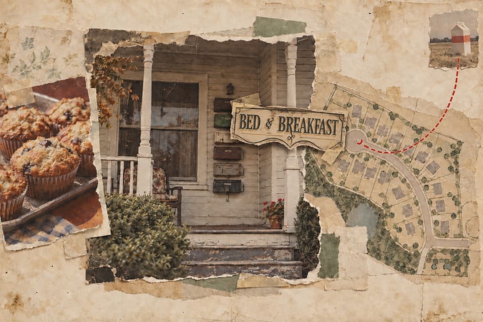
In the 1970s Ashland chose a growth strategy focused on infill over sprawl. Before housing started creeping up into the hillsides, the “good” parts of town were mostly in new subdivisions, in Quiet Village, in Greenmeadows, and at Oak Knoll. The old parts of town, the Railroad District, around Briscoe and the library, were filled with small, often run-down, housing, interspersed with larger houses built by the city’s merchant class before WWI but no longer considered “modern” or very desirable. Many of the bigger houses had been converted to multiple occupancy or “SROs,” meaning “single room occupancy.” Landlords would put a dead bolt on each bedroom door, sometimes convert the living room or even the garage into another single rental, and a group of residents would share the kitchen and bathrooms. It wasn’t at all uncommon, on B Street, or Oak, or Siskiyou, to see a front door flanked by five or six wall mounted mail boxes, each representing an affordable single-room rental. OSF used to house its actors in these rooming houses, while other rooms were occupied by waitstaff or kitchen crews, students or seasonal workers. In retrospect it was all quite bohemian but the cross pollination of workers, actors (former actors working in restaurants) and artists created an amazingly creative underbelly that surely inspired much of what Ashland did. If you are an old townie, you will recall the great 4th of July parade entries from the “B Street Bees,” which survived into the early 1990s.
But by the 1980s the historic architecture in Ashland’s core became more popular and property values and rents started to climb as young families, and then retirees, purchased and renovated them. Owners of former rooming houses profited from the city’s new Bed and Breakfast ordinance, and new owners converted what had been housing for 4-6 people into traveler’s accommodations, taking off all the mail boxes, restoring the interiors, learning how to make muffins, and putting up monument signs with indirect lighting, before renting those rooms by the night to tourists.
So the housing in the Railroad District, and much of the Skidmore-Academy District (north of Main Street, by Briscoe School), although zoned for multiple family (and which had provided some, as rooming houses), and still part of the city’s “buildable inventory,” began to become too expensive for it. Those parts of town with mature trees and sidewalks became more desirable and so even when there was a vacant lot, the cost of the land and the city’s planning practices (including the Historic Commission) meant that most new or replacement construction remained Single Family Residential (SFR). The city’s development limits (Floor Area Ratio (FAR), solar, setbacks and parking) didn’t help. Very little, if any, new multiple-family housing happened. Nobody built an apartment building, at least one of any size, in Ashland for decades.
Meanwhile, at the town’s periphery, along Mountain, East Main, or Tolman, where there were large open parcels (either ranch land or old mill sites), the city allowed new single-family (SFR) development almost exclusively without any commercial or employment development. Even when a development wanted to build a small neighborhood commercial area (as in the project across from North Mountain Park), neighbors and others (including a land-use watchdog group called “Friends of Ashland”) opposed and killed it. Too much traffic! Too much lighting! People! All of which meant that all this new SFR development had to drive into town to get a carton of milk. The University built slightly more dense student housing (still only 1 ½ or 2-story) for its own purposes and there were some HUD-supported units in older apartments, but not enough. Houses that weren’t converted into B&Bs reverted to large single family homes or office space.
All of which meant that all this new SFR development had to drive into town to get a carton of milk.
City water supply (and waste water) became issues, and the new “Meals Tax” (aka the Food and Beverage tax) was passed as a way to fund a bigger waste water treatment plant. The city sweetened the pot by dedicating 1% for new park land acquisition, but almost immediately added 4% to offset the cost of the WWTP. Proposals to build a pipeline that would allow Ashland to buy water from Medford, the “TAP” line, stalled, as many in town thought limiting water would limit growth.
Amid all this, developers, with the city’s tacit support, just went for the low-hanging fruit, SFR, and that’s what was built, mostly for in-migrating retirees and others with means. SFR went everywhere, even in those areas of town zoned for dense development. Attached condominiums, one and one-half story, with high prices, were about as dense as Ashland allowed. Low-budget renters, both hourly workers and retirees, were left to fend for themselves, which often meant commuting from Talent, or Phoenix or Medford. Working class families were priced out, or they cashed out as their older homes were suddenly far more valuable than anybody ever expected they would be.
Next, property taxes. Contents
Part 6 Property Taxes

[Many newer residents of Oregon are unfamiliar with the state’s rather odd taxation system, other than being pleased we don’t have a sales tax.]
Oregon’s cities and counties rely, mostly, on property tax revenue, charged as a percentage, a “mil rate,” against the value of private property. Non-profit groups, the government itself, and churches, don’t pay property taxes, which means that in Ashland, with School District 6, SOU, the city, churches and all the non-profit and charitable organizations, much of town isn’t taxed.
The mil rate multiplied by the assessed value (written $XX/1000) determines your taxes. The mil rate reflects the tax against every $1000 of value, so if the “tax rate” is $10 per $1000, and your property value is $300,000, your property tax bill would be $10 x 300, or $3000. In the 1980s, as property values in Oregon skyrocketed, this resulted in huge windfalls for local governments, windfalls that some people found excessive. Some Oregonians, including many recent residents from our neighboring state to the south, unhappy with our high income tax (and not mollified by our lack of sales tax), pushed to roll back the state’s property tax revenues. The result was “Measure 5,” a voter-passed initiative adopted in 1990, which cut property tax revenue by an average of 50%, limiting the mil rate to $15/1000 of value, a maximum of $5/1000 for schools and $10/1000 for everything else, cities, counties, etc. Locally passed bonds, like Ashland’s school levies for schools or bonds for the fire stations, and more recently the Library District, are allowed to exceed the $15/1000 cap.
When cities and counties responded to Measure 5 by paying really close attention to property values and reappraising them accordingly (worth doing, as property values during this period grew rapidly), voters responded by passing Ballot Measure 47 in 1996. Measure 47 fixed “Assessed Value,” as distinct from “Real Market Value,” essentially cleaving property values and local government funding from reality. Oregonians would henceforth be taxed on a calculated value based on what their property was worth in 1995-1996 rather than what it was actually worth. Measure 47, like much of the law written by anti-tax zealots, was a mess and after it passed, the Legislature referred Measure 50 to the voters to fix its problems at the next election. Measure 50 mandated that assessed value for tax calculation purposes could only grow by 3% per annum, no matter the actual value of a property, a number that hit harder in communities that were successful, than in those that were stagnant. Property could be re-evaluated if there were major additions and renovations, but only if that work cost more than a certain amount. Otherwise, no matter how much your house was worth, it was taxed at its calculated value, now called its MAV (Maximum Assessed Value), almost always far lower than its actual worth. If you own property, compare your MAV (Maximum Assessed Value) on your bill from the County and see if you would actually sell for either that value (or your RMV, your “real” market value).
Unlike Prop 13, in California, these artificially low values stayed with the property, unaffected by changes in ownership. If you own a parcel in Oregon, haven’t done any major renovation, and not sold it, your value is whatever it was in 1996, subject only to the 3% step increases.
This was all great, if you were a property owner, but not so great if you ran a government that was faced with the reality of increased costs. Virtually everything, of course, from health care, labor, and paper clips, regularly goes up more than 3% a year. This forced government to either cut services or seek increased revenue.
In the face of this constraint on their revenue, many (most?) cities chose to increase their taxable base by annexing additional land, or by approving new development. For some Oregonians (there was an entire other group, organized as Oregonians in Action, who despised statewide land use and kept trying to have it repealed without success) that was sort of the entire point. “Hey government… don’t want to starve? Then you had best allow us to build these subdivisions and be quick about it!”
Ashland, which had long refused to annex land or expand its Urban Growth Boundary, leaving much of its periphery under the control of Jackson County, had limited options. Ashland could continue the focus on infill, promoting and encouraging dense development inside the city limits, both to provide for growth (as it was required to do) or just as a way to keep up with its growing costs of operation. But lots of folks liked Ashland just the way it was. They voted in leaders who would often “talk” about the lack of housing, or rising costs, but weren’t really interested in doing much that would impact our lovely little town. “Workers can live in Talent” was sort of the operative mindset.
“Workers can live in Talent” was sort of the operative mindset.
Ashland would have to find some other way to address the growing cost of government. Since Ashland is one of only a few cities in Oregon with a publicly owned electrical utility (many cities operate their own water/sewer systems), utility rates, utility taxes, and fees that could be added monthly to everyone’s utility bills was an obvious mechanism to generate additional revenue for city operations. And, as Ashland ratepayers have seen, especially in the last 18 months, the City of Ashland fully intends to use its utility monopoly as a way to avoid having to even think about the cost of government beyond regressively extorting more and more money from its 21,000 residents at every turn.
Update: The status quo complains, “Ashland is located in a narrow valley, we don’t have room to grow like Medford due to our geography!” That is partially true, but the fact that areas for city development in Ashland are more constrained are entirely the result of earlier city decisions about our periphery. Look at the development in the hills east of downtown Medford, on the other side of North Phoenix Road, to see how other cities dealt with “constraints.” And, of course, Ashland’s wanton spending and reliance on utility fees and taxes is causing its own sort of pushback from residents.
Next, demographics. Contents
Part 7 Demographics

(Given the city’s current issues, this seems as timely as ever. As written in 2022, but still valid.)
In 1990, when Oregonians adopted Measure 5 and the impacts of that law on government funding were first felt, Ashland’s population was 16,200 persons. In 2020, three decades later, population had grown to 21,400, a rate of just 1.2% since 2010. (Note, in 2026, Ashland population is reported as 20,800, a decline.) Median household income in Ashland is $68,028, with a poverty rate of about 15%. Income per person is $43,076. The median age is about 47.7 years old, two years older, on average, than four years ago. All this data comes from worldpopulationreview.com, relying on US Census data. (These are numbers from 2026.)
Conversely, in Medford, those numbers are much higher. Between 1990 and 2020 Medford grew from 47,000 to 85,800, growing 2.54% since 2010. Today, Medford’s population is 86,500, losing just 11 persons in the past year. Median household income is $73,230, income per person is $46,497, the poverty rate is 13.17% and the median age is about 39 years.
(cue the “We don’t want to be Medford” chorus)
Several things jump out at me, along with the obvious fact that Ashland is not growing in step with the rest of the valley (Look up Eagle Point or Central Point, if you want real eye-opening comparisons). First, of course, is that we are older. Our incomes are lower, about $5,000 a year less per household than Medford’s, and we are poorer too, with a higher percentage earning at or below the poverty rate. A lot of people in Ashland are barely scraping by.
(cue the “Oh, that’s just the SOU student effect” chorus)
The shift in our demographics, toward the wealthy, toward the older, has huge impacts, both good and bad. Obviously, equity immigrants and retirees, with ample funds and time, bring a bunch of skill to the community. That’s good. But they also drive up prices for housing (“It’s so cheap here, compared to (fill in former city)!”), gobbling up former rentals, and making it harder for young people to live and work here. And that means our school population is impacted. Ashland closed two elementary schools in the past 20 years, as families with children moved out. There is now talk of closing another, as student population declines. Even young professionals can have trouble finding a place in the community. Ashland continually struggles to make strides toward diversity and equity in almost all its forms.
Think about the simple, obvious, fact that even with all the development in Ashland since 2000, all the new residential construction on Mountain, East Main, off Tolman, and Clay, in the former railroad yards north of A Street, or off Nevada by the dog park, that our population has actually declined in the last four years. Think about the big houses on B and Oak that used to house five or six renters (or more) that are now offices, or private residences. Think about how little has been built to replace those lost, affordable, rentals. Ashland has the illusion of “infill,” but little actual growth. We, effectively, have less people living in more space. That’s not how infill is supposed to work. I have called our growth pattern “hollowing out.”
Ashland has the illusion of “infill,” but little actual growth.
Aside from raw numbers, perhaps the biggest impact is how this all affects Ashland’s future and, frankly, its character. Four or five decades ago the cost of entry to live in Ashland was pretty low. And with that so was the risk of failure. A young person could move here, be seized by inspiration to buy a restaurant or start a health food store and fund it on a credit card (I know people that actually did that, btw). Rents, both residential and commercial, even on the Plaza, were cheap. So was home purchase. In the 1970s you could buy a decent house, above the boulevard, for $20,000. In the early 1980s you could buy a decent house almost anywhere in town for less than $50,000. I know. I did. People came here with little more than an idea. And, with cheap housing, you could find a job, start a company, hire others, and succeed. Some came here as professionals and bought run-down properties, converting them into restaurants. Or theatres. Or both. Others started a retail business or took over and expanded an existing one. People raised families, and their children could reasonably expect to live and build a life here too. Ashland benefitted tremendously from all of this. We were entrepreneurial, creative, and it made for an amazing community and quality of life.
(cue the “that was then, this is now” chorus)
Equity immigrants, retirees, are great, don’t get me wrong. But few of them are taking huge risks. Why should they? Few are starting businesses and, sadly, too many just want things to remain “perfect,” the way things were the day they arrived in Ashland. Too many, with the best of concerns, fret about change. And new development. And traffic. And noise. They are all for workforce housing, as long as it’s not in their neighborhood. Or too tall. Or bulky. Or not attractive enough. Or require a tree or two to be lost. Or block the view. They enjoy the benefits of a fully-funded city (they can afford the minor upticks in the utility tax) and are happy to pay. “Isn’t Oregon great, it doesn’t even have a sales tax!” And, all too often, such people have the time and the inclination to get involved in politics, either directly or by working for or funding candidates, where they can ensure that we take an ever more cautious approach to change. If they don’t serve, they support and vote for leaders that may not exactly codify that caution but who will assure that nothing happens too quickly. “We don’t want to kill the golden goose,” they will say. “We should create a committee and study that.” Working people only rarely have the time, let alone the inclination, to serve in city government and so we get a self-reinforcing circle that makes it ever harder for working people to even remain in town.
And so, while there is lots of talk and hand-wringing, nothing much happens to address economic or demographic diversity. We have grown timid. The types of businesses that do open here are all of a type, all too often require outside equity and experience and most, at least lately, struggle to find workers. That has only accelerated post-pandemic. Trying to build anything in Ashland, unless it’s a $500K+ single family residence, well, how much time do you have for process? How much can you afford for planning costs or studies, or fees? Won’t that generate a lot of traffic? Can the water supply handle that? Will it impact evacuation in a fire event?
So even if somebody wants to take a risk, and try something new, build something new, or open something risky, it’s almost impossible without considerable investment and support. And all too often even with those things it’s a daunting task. By design. Ask people who have tried. And that, my friends, is not the way great communities remain great. It’s the way they stagnate.
Having watched Ashland for almost fifty years, forty as a fairly engaged full-time resident, I think we, with perhaps the purest of motivations, have nevertheless lost much of the creative abandon that transformed Ashland from a mill town and made it so attractive in the first place. I wonder if it’s possible to get that creativity, that “nerve,” back. I wonder if most residents or our leaders notice or even want to try.
Next (and last), a recap and what we can do (if we want to do anything). Contents
Part 8 A Recap, and What We Can Do
So, what do we do?
If you have stuck with me through this series, you know that Ashland once envisioned a change from a mill town to a tourist town and, under the guidance of the Committee of Fifty, worked together to help that succeed, changing the community irrevocably. You know that we made a decision to grow inside the city limits, so as to protect the rural land around us, and you know that Oregon tax law creates huge pressures on municipal budgets if they don’t have new construction. And you know that while Ashland “talks” infill, for a variety of reasons we don’t really walk that walk, at least in any way that supports workers and young families, unless they have other resources. And you know that in recent years, with rising prices and little effort to diversify, those decisions have, predictably, come home to roost.
So the first question is do Ashland residents, and their leaders, see any of this as a problem. And, if a majority of us do, what can be done, if anything, to change the equation and make Ashland more diverse and more affordable for working families, to create equity and living wage jobs, and try and assure that new businesses can find local workers and succeed. Is it, as some conveniently believe, just too late?
I don’t know. Nobody does. But I certainly think that it’s imperative that we try. That we be creative, take some risks, and trust that Ashland is, as it has always been in the past, resilient enough if we make a mistake or two. I just don’t think we can continue as we have. We will lose most of what makes Ashland special.
So what to do? Here’s a list, built off of concepts I first posted four years ago, revised two years ago, and now edited and updated again.
First, and most importantly, we need to talk as a community about our future in an open and collaborative way. Maybe we need our leaders, maybe another Committee of Fifty, to envision a future that we can all support and suggest the changes to City Council to help get us there. We need to think outside the box. We need to recognize that neighborhood based concerns don’t elicit city-wide change. We need to make tradeoffs for the good of the community we want to become. And we need to learn that not everyone gets everything that they want. We need to stop being so damn timid about change.
We need to stop being so damn timid about change.
Second, the city needs to get its spending under control, partially so that people can afford to live here but mostly so that the ample amounts in the City’s budget can be used as wisely as possible toward solving the community’s problems. We need to prioritize the citizens, not the city government. The city needs to seek solutions that will work, not necessarily what is the best.
Third, we need to work with our representatives and make changes to Oregon law that allow cities like Ashland to better control their destiny. We need to remove the statewide ban on real estate transfer taxes, we need to consider property tax reductions for owner-occupied housing below a certain value cut-off, to be offset by increases on commercial land and rental/income properties, and we need some form of rent control or large scale public land ownership, to remove the incentive for speculation and hoarding of land by special interests. Oregon’s entire tax structure needs to be revisited, to make it better able to shift costs to those that most afford it.
Ashland needs to re-examine our land development ordinance and the way it is applied so as to incentivize the sort of development/construction we need, and de-incentivize or outright eliminate the kind we don’t. Some easy changes would include the following, all of which could be adopted by the city quickly, if it wanted to do so. (NOTE: State law has changed some of these since 2022 and the recent land use code changes proposed by councilors Dahle and Sherrell would address others.)
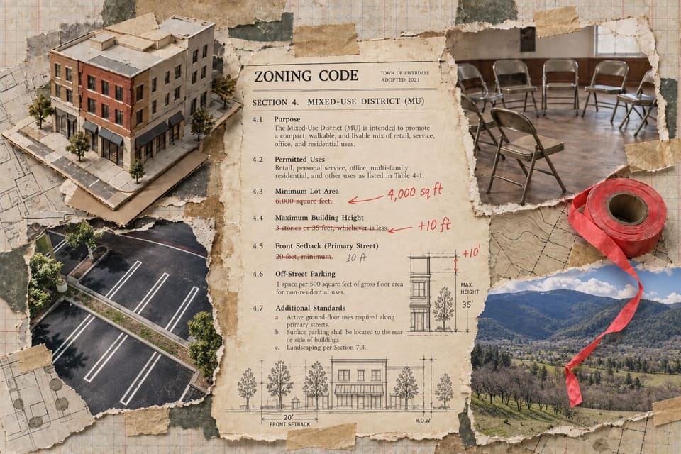
- Reduce the minimum buildable lot size to 4,000 square feet. This will reduce the cost of a house site and increase the housing potential on our available land inventory by 20% immediately.
- Repeal the solar access ordinance. It was a nice idea, but it is incompatible with an infill strategy.
- Explore reductions in setback requirements, both front and side yard. They waste land. Front yards are aesthetically driven, side yards, to a degree, by fire code but there are alternatives for each.
- Make it easier to build multi-family condos, apartments, and townhouses.
- Eliminate building under the zone. If you have property in an R2 or R3 multi-family zone you should be prohibited from building an R1 structure. PERIOD. (Maybe an exception for fire reconstruction.)
- The State has adopted rules that make Accessory Dwelling Units legal in all residential zones. Encourage that locally by fixing code obstacles regarding setbacks, above, and off-street parking, below. Create low-cost financial support (forgivable city loans, access to other forms of funding support, permit relief) to encourage the construction of ADUs and in-house rental conversions to support existing home owners and increase rental inventory. These changes help create demographically diverse neighborhoods, maximize our existing land base, and can help to keep empty-nest seniors in the family home.
- Raise the height limit in all zones by at least ten feet (one story), to allow multi-story development. Certain areas along designated arterials should be raised even more. We should be seeing, regularly, 3-4 stories in all new development with the occasional five or even six story building in select zones and sites (ask about TDRs, if you are curious). Additional height limits can create significant new housing opportunity by reducing the land cost per s.f. for development and more efficiently using existing infrastructure to service it. [Note: I might go even further now, as height is a significant limiting factor to infill economics.]
- Repeal the requirement for off-street parking. Yeah, I know, traffic sucks and parking is a hassle. But adding building height enables ground floor parking potential without sacrificing land and housing area. Making parking optional (some projects will market themselves as having off-street spots) also recognizes and supports the shift to walking/biking/public transportation and creates choice and frees up land. The amount of land we devote to automobiles is criminal, a remnant of another era. (We should, as part of this conversation, focus on true walkable neighborhoods and neighborhood commercial uses so that people don’t have to drive everywhere.)
- Encourage neighborhood commercial zones, with small retail and even light-manufacturing of the live/work type in new construction. Neighborhood commercial breeds community, reduces the need for a car, and promotes walking and health.
- Establish a community based land trust to own and manage affordable/workforce housing and undercut the ability of large rental owners to manipulate rents in a constrained market. Competition is good. Give CPM and the other major rental owners some competition. [This has been done, as I understand it, but the City should get serious about actually funding it.]
- EXPAND the city footprint… buy the Billings Ranch (and its water right) and add the potential for 1000s of new housing and live-work units to grow the city and its tax base.
- Loosen up about the Croman property and make sure that it can be developed to fit the vision of an Ashland future we support. Stop whining about traffic and views and noise. Cities change. Or cities die and become museums.
I firmly believe that if Ashland is going to continue to thrive and survive, we need to make some significant adjustments to the way we approach change. And the majority of Ashlanders need to recognize that there is a problem and want to fix it.
Thank you for sticking with me. You may now return to your (shorter) regularly scheduled social media feed.
George Kramer is a historian who has watched Ashland for almost fifty years, forty of them as a resident. He works in historic preservation, chaired the Ashland Historic Commission in the mid-1980s, and nominated all four of Ashland’s historic districts to the National Register of Historic Places under contract to the city, as he discloses in Part 3.
He is also a regular speaker at City Council meetings, where this paper has reported his testimony, most recently on the parks fee. He led the petition campaign behind Measure 15-243, the charter amendment on the November ballot that would require voter approval for most new or increased fees on utility bills, as Jefferson Public Radio has reported. Part 6 of this essay argues against those fees. This essay is his argument and not the paper’s.
The eight parts were written as a social media series, which the author dates to 2022, and revised by him in September 2026 for this paper. The Ashland Free Press combined them into one article, added the section headings, the contents and the links between parts, and corrected spelling and punctuation. With his agreement it also corrected two growth rates in Part 3 and the year of Measure 47, and reworked the income figures in Part 7 against the source he names. The figures are the author’s own, from the sources he names.